 Agent
Agent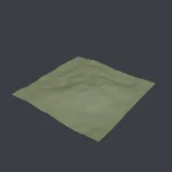
What this component contains
ATTRIBUTION.mdLICENSEREADME.mdcomponent.jsongraphcheck.pyheightmap_terrain.pymeshcheck.pypreview.pngtest_heightmap_terrain.pytest_package.pyverification/native.json
How it works
- Operator
- baltor.heightmap_terrain
- Parameters
- size, resolution, height, feature_size, octaves, lacunarity, gain, ridged and 5 more
- Result
- One smooth-shaded mesh object named Terrain with a UVMap and a sea vertex group.
- Blender
- 4.2 or later
- Axes
- Blender Z up, -Y forward
- Units
- metres
Recorded checks
blender 5.2.1 LTS (hash 9e2066aef7ef built 2026-08-25 02:12:34)
addon_install_and_enableoperator_runs_with_defaultsblender_data_matches_coreaddon_disable_unregistersscript_mode_runsclean_reopen_addon_fileclean_reopen_script_filegltf_separate_exportengine_output_clean
Limits to consider
A height field: no caves, overhangs or erosion simulation. Gradient noise on a square lattice can show faint axis alignment. Terraces use a quartic softened step and island falloff a radial smoothstep, both stylized rather than geological. High resolutions are slow in pure Python (1024 cells per side is about a million vertices). Verified in Blender 5.2.1; written for the 4.2 API.